
The Tolkien Trail is a world-renowned walking route that offers a deep connection to the literary history of Middle-earth.
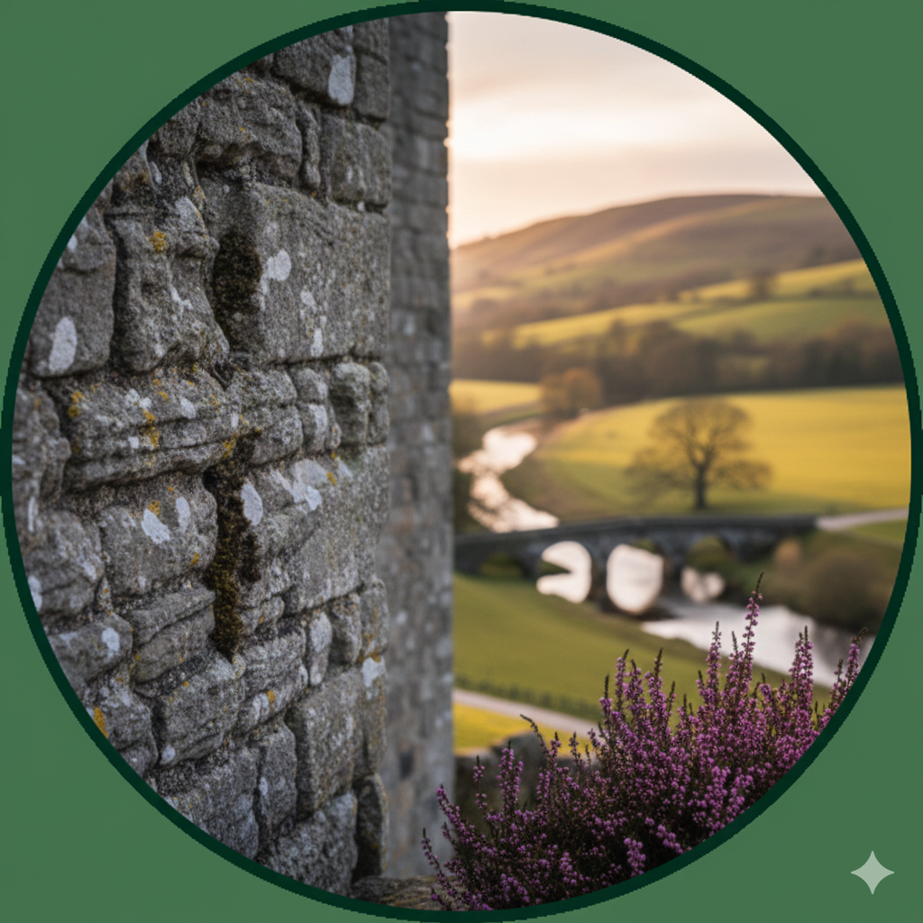
J.R.R. Tolkien frequently stayed at nearby Stonyhurst College, and many believe this lush, rolling landscape provided the inspiration for the Shire in The Lord of the Rings.
The Ultimate Middle-earth Walk
The trail is a circular route starting and ending in the charming village of Hurst Green. It is a favoured destination for literary fans, hiking groups, and families who want to experience the “Old England” charm of the Ribble Valley.
- The main Tolkien Trail is approximately 6.5 to 7 miles long and typically takes around 2.5 to 3 hours to complete at a steady pace.
- The route passes several significant landmarks, including the impressive buildings of Stonyhurst College, the Cromwell’s Bridge ruins, and the confluence of the Rivers Hodder, Calder, and Ribble.
- The terrain is a mix of woodland paths, riverside tracks, and open fields; it can become quite muddy in the winter months, so sturdy walking boots are essential.
- Visitors can choose from various route lengths depending on their ability, ranging from a short 1-mile “Feed the Ducks” family stroll to a more challenging 12-mile “Fell & River” trek.
Important Visitor Information
- Star Rating: Highly rated by walkers (4.6/5 stars) for its scenic beauty and cultural significance.
- Opening Times: As a public walking route, the trail is open 24 hours a day, year-round.
- Prices: Completely free to walk. There are no admission fees to access the public footpaths.
- Parking: Available within Hurst Green village; visitors often park near the Shireburn Arms (Postcode for Sat Nav: BB7 9QP).
- Refreshments: The village of Hurst Green offers several stops for a post-walk meal, including the Shireburn Arms and Millie’s Cafe.
Contact & Maps
- Website: thetolkientrail.com
- Route Maps: Digital maps for the various routes can be found directly on the official website’s Maps page.